Ambitious targets have been set for forest expansion across England which will provide opportunities for woodland birds but, if established/planted in the wrong place, may impact negatively on species reliant on open habitats.
The key will be putting the right trees in the right place.
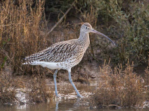
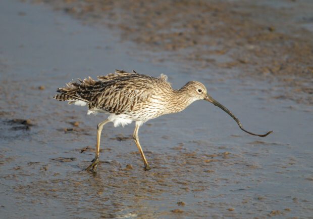
Breeding waders, such as the Curlew and Golden plover, which are reliant on open habitats during the breeding season, are of conservation concern because of their declining populations and the international significance of some of their UK populations.
The Forestry Commission have been working with the British Trust for Ornithology (BTO), Natural England and others to develop wader zonal maps which help identify important areas for the recovery of breeding waders based on scientific modelling of Bird Atlas and environmental data sets.
The wader zonal maps have been refined further with a bird survey carried out in 2021 funded by the Forestry Commission in northern England. The wader zonal maps, along with other decision-making tools will help to guide and inform woodland expansion in England that works with breeding wader conservation.
The maps are not a definitive map of wader populations or distribution, instead they use the best available information to provide a broad indication of areas of likely importance for waders.
John Calladine, Senior Research Ecologist at the BTO, said,
Delivering the benefits of reforestation while minimising adverse impacts on breeding waders requires accessible information on their distribution. This would allow woodland expansion to be targeted away from key wader areas.
He added,
As well as guiding decisions about where to plant trees, the wader maps also yield insights into the relative importance of different regions, landscapes, protected areas, habitats and land uses for breeding waders. This information can also be used to inform decisions about where efforts to achieve sustainable and long-term solutions for wader conservation should be focused.
We are indebted to our dedicated volunteers who collect the raw data on bird distribution without which the development of tools such as this would not be possible.
Neil Riddle, Principal Adviser – Natural Environment at the Forestry Commission, said
The wader guidance explains how the Forestry Commission’s Land Information Search (LIS) can be used to access relevant spatial data layers. The BTO wader zonal maps found on the LIS categorise the predicted relative abundances for each species in each one-kilometre square into discrete strata producing a ‘heat map’. Predicted bird numbers are lowest in stratum 1 (cool) and highest in stratum 5 (hot).
Sarah Anthony, Senior Environmental Specialist – Ornithology, Natural England, said
Natural England welcomes the development of these maps which are a helpful component of the guidance and give an indication, at a broad scale, of key areas for breeding waders. A strategic approach at a broad spatial scale is vital to understand the impacts and to identify the best opportunities for both biodiversity and woodland expansion.
This project to develop the wader zonal maps was a partnership between the British Trust for Ornithology, Scottish Forestry, Forestry Commission, the Cairngorms National Park Authority (CNPA) and Working for Waders.
The final report describing the models used to develop the wader zonal maps can be found on the BTO website.

1 comment
Comment by Michael Irons posted on
Makes very good reading, glad to see things are under control and great plans in place for future generations with our environment.